PLENARIES
The MedGU-26 Steering Committee has invited, and also received requests from, renowned and distinguished scientists from around the world to deliver plenary lectures on cross-cutting themes in the Earth sciences. Additional plenary speakers will be announced over the coming weeks.
We are grateful to all those who have accepted our invitation to serve as plenary speakers at MedGU-26 (see Scientific Program):
Plenary 1: Seeing the Arid Earth in Hyperspectral Detail: Tectonics, Mineral Resources, Dunes, and Sabkhas
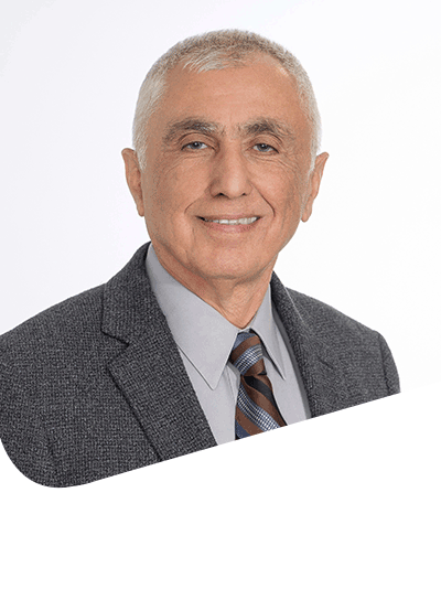
Mohamed Sultan

The deployment of the Earth Surface Mineral Dust Source Investigation (EMIT) sensor on the International Space Station and acquisition of EMIT data with its high spectral resolution (~7.5 nm), extended range (381-2493 nm), and large number of bands (285 bands) offer long-awaited, unparalleled opportunities for plate reconstructions, lithologic mapping, mineral exploration, dune sources and transport pathways, and sabkha genesis and evolution. We integrate EMIT observations with traditional data sources to accomplish the following: (1) correlate the lithologies and structures along the Red Sea coastlines and investigate the validity of pre-Red Sea reconstructions, (2) detect lithium bearing deposits across the Arabian Nubian Shield, (3) constrain the provenance and sediment pathways of dune fields in the Arabian Peninsula (AP), and (4) identify the distribution, types, composition, and origin of coastal and inland sabkhas in the AP.
Dr. Sultan is a Remote Sensing and Environmental Sciences Professor and the Earth Science Remote Sensing (ESRS) Facility Director at Western Michigan University in Kalamazoo, Michigan, USA. He held multiple positions, including Senior Research Associate in the Earth and Planetary Remote Sensing Facility and the McDonnell Center for Space Sciences at Washington Univ., Project Manager for International Programs at Argonne National Labs, Professor of Remote Sensing at the State Univ. of New York, the Chair of the Dept. of Geological and Environmental Sciences at Western Michigan Univ., and the Chair of the Michigan Geological Survey. He also served as a Research Professor in the Dept. of Geology, Univ. at Buffalo, New York, an Adjunct Associate Professor in the Dept. of Earth and Environmental Sciences, Univ. of Illinois, Chicago, IL, an Adjunct Professor in the Dept. of Geophysics, Cairo Univ., Visiting Professor in Ain Shams University, and the Associate Editor of the Geological Society of America Bulletin. Dr. Sultan earned a Ph.D. in Earth and Planetary Sciences at Washington Univ. and a BSc and an MSc in Geology from Ain Shams Univ. Dr. Sultan has been a member of the Science team of NASA’s Gravity Recovery and Climate Experiment (GRACE) and GRACE-Follow-On (GRACE-FO) Missions since 2009. He recently (2024) joined the Science team of NASA’s Earth Surface Mineral Dust Source Investigation (EMIT) hyperspectral Mission and NASA’s Surface and Interior program. He is a Fellow of the Geological Society of America (GSA), the first recipient of the GSA’s Farouk El-Baz Desert Research Award, and the recipient of the 2023 Kuwait Prize in the field of Applied Sciences – Hydrology from the Kuwait Foundation for Advancement of Sciences (KFAS). He published 118 peer-reviewed articles in leading scientific journals, most of which address hydrological, environmental, and geologic issues in the Middle East. Dr. Sultan is an interdisciplinary scientist who takes advantage of available tools (remote sensing, geochemistry, geophysics, GIS, machine learning, and modeling) to address a wide range of timely and complex hydrologic, geologic, and environmental problems in tectonics, geochronology, geochemistry, climate change, hydrogeology, and water resources. He secured funding (59 projects worth US$ 9 million) from Federal agencies, including NASA, NSF, NOAA, USAID, USGS, the National Academy of Sciences (NAS), and governmental agencies including the Saudi Geological Survey (SGS), King Saud Univ., KFAS, the Qatar Ministry of Municipality, and Egypt’s Ministry of International Cooperation.
Plenary 2: Beyond Prediction: AI-Driven Decision Support for Natural Hazard Management

Hossein Bonakdari
Climate change is accelerating the emergence of interconnected natural hazards, increasing not only the frequency and intensity of extreme events but also the occurrence of cascading processes in which one hazard modifies environmental conditions and amplifies the likelihood of subsequent hazards. Prolonged droughts alter vegetation structure and fuel moisture, increasing wildfire susceptibility, while wildfire-induced changes in soil properties, land cover, and watershed response can substantially intensify post-fire flooding, debris flows, and erosion. These complex interactions challenge traditional single-hazard approaches and call for integrated frameworks capable of capturing the dynamic relationships among climate, landscape evolution, and hydrological processes.
This plenary presents recent advances from our research on AI-driven decision support for cascading natural hazards, with a particular focus on the drought–wildfire–flood continuum. The work integrates multi-source Earth observation data, remote sensing, climate information, topographic and hydrological datasets, and environmental variables within advanced machine learning and GeoAI frameworks to improve hazard susceptibility mapping, wildfire prediction, flood forecasting, and spatial risk assessment. Rather than viewing these hazards independently, the proposed approaches explicitly account for their interactions and cumulative impacts across space and time.
A central theme of the presentation is the development of trustworthy AI for environmental decision-making. The talk will demonstrate how Explainable Artificial Intelligence (XAI), uncertainty quantification, Bayesian optimization, ensemble learning, and reinforcement learning can enhance both predictive performance and scientific understanding by identifying the dominant environmental drivers, nonlinear relationships, and spatial dependencies governing hazard evolution. These advances transform AI from a black-box prediction engine into an interpretable and reliable decision-support tool.
Beyond prediction, the presentation highlights the evolution of AI toward operational intelligence. Examples from recent research will illustrate how predictive models can support early warning, resource allocation, mitigation planning, infrastructure resilience, and climate adaptation by delivering transparent, actionable information to emergency managers, planners, and policymakers. The integration of explainability, optimization, and uncertainty analysis enables more informed and defensible decisions under rapidly changing environmental conditions. Moving beyond isolated hazard prediction toward holistic, explainable, and operational AI frameworks offers a new paradigm for managing cascading natural hazards and strengthening societal resilience in an era of accelerating climate change.
Dr. Hossein Bonakdari, Ph.D., P.Eng., is a Professor in the Department of Civil Engineering at the University of Ottawa, Canada, and an internationally recognized expert in Artificial Intelligence for environmental and climate systems. His research lies at the intersection of artificial intelligence, geospatial analytics, hydrology, hydraulics, remote sensing, and environmental data science, with a focus on developing next-generation AI solutions for climate resilience, water resources management, and natural hazard assessment.
Over the past two decades, Dr. Bonakdari has pioneered the development of physics-informed AI frameworks for complex environmental systems. His research has advanced machine learning, deep learning, GeoAI, and hybrid intelligence approaches for flood forecasting, drought assessment, wildfire susceptibility modeling, hydro-meteorological prediction, climate-risk analysis, and AI-driven decision-support systems. By bridging fundamental AI research with operational applications, his work has enabled more transparent, reliable, and actionable tools for environmental management, disaster resilience, and sustainable infrastructure planning.
Dr. Bonakdari has authored more than 350 peer-reviewed publications, including eight books, over 30 book chapters, and has delivered more than 150 keynote, invited, and conference presentations at international scientific meetings. His publications have received over 11,000 citations, and he has an H-index of 62, reflecting the broad impact of his research across civil engineering, environmental sciences, hydrology, and artificial intelligence. He has been recognized among the World's Top 2% Scientists since 2019, highlighting his sustained scientific excellence and international leadership in AI-driven environmental research.
Plenary 3: Mediterranean water towers under pressure: how global change is reshaping water resources
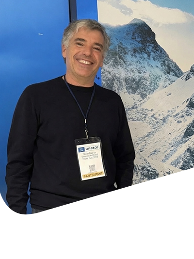
Juan Ignacio López-Moreno
Mediterranean mountain regions have experienced profound environmental transformations over recent decades, driven by population dynamics, shifts in vegetation cover and climate change. Although mountains occupy a relatively small proportion of the landscape, they generate a disproportionate share of water resources, making them essential for sustaining ecosystems, supporting economic activities, and securing water supplies for both upland communities and densely populated downstream regions.
As global change alters hydrological processes in mountain headwaters,runoff generation is declining, placing increasing pressure on water availability and challenging existing water management systems. These changes have far-reaching implications, with potential cascading effects on ecosystems, agriculture, hydropower production, and urban water supply across the Mediterranean basin.
This plenary keynote will explore the multiple dimensions of global change affecting Mediterranean mountain environments and examine their consequences for water resources and hydrological dynamics. It will also present future projections of climate and land-cover change, highlighting their implications for water security in the decades ahead. While the discussion will address challenges across the Mediterranean region, it will draw extensively on decades of research conducted in the Pyrenees.
Juan Ignacio López-Moreno (Zaragoza, Spain, 1974) holds a PhD in Geography and is a researcher at the Pyrenean Institute of Ecology of the Spanish National Research Council (CSIC). His research focuses on the evolution of climate, snow cover, and glaciers in alpine and Arctic environments, their response to global change, and the impacts of a changing cryosphere on hydrology, water resources and landscape evolution. He is the author of more than 280 peer-reviewed scientific publications and several books. His publications have received over 27,000 citations.